LMR/TOD outcomes for the DA pathway
$199per LGA
$1,990statewide

Understand the impacts of intricate planning regulations across hundreds or thousands of properties using PropCode's unique analysis data.
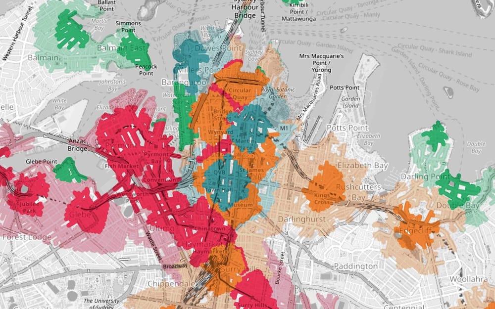
NSW planning reform data
Higher density and more permissibility near 200+ stations and centres across NSW.
The LMR and TOD reforms have created massive opportunities for medium and high density residential projects that weren't allowed before. With over 240,000 properties in these areas, many hidden gems can be found if you can quickly assess the impact of the new rules per property. Our unique dataset has been ordered by local, state, and national government to help them understand the reforms.
| Lot | Area | Zone | Height | FSR | Band |
|---|---|---|---|---|---|
| 12/3/DP45678 | 651 m² | R2 | 9.5 → 17.5 | 0.5 → 0.9 | LMR 400m |
| 7/DP123456 | 588 m² | R3 | 11.5 → 22.0 | 0.7 → 1.5 | TOD |
| 15/DP80442 | 702 m² | R2 | 9.5 → 16.0 | 0.5 → 0.8 | LMR 800m |
| 2/DP661903 | 449 m² | R1 | 8.5 → 8.5 | 0.5 → 0.5 | — |
New permissibility and built form controls under the reforms, with height and FSR uplift computed against current LEP values.
Sample extract — illustrative values
Request a free sample of the LMR/TOD dataset.
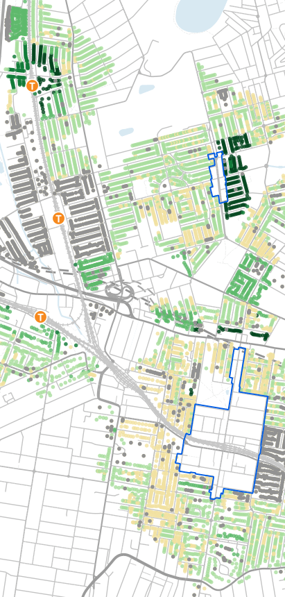
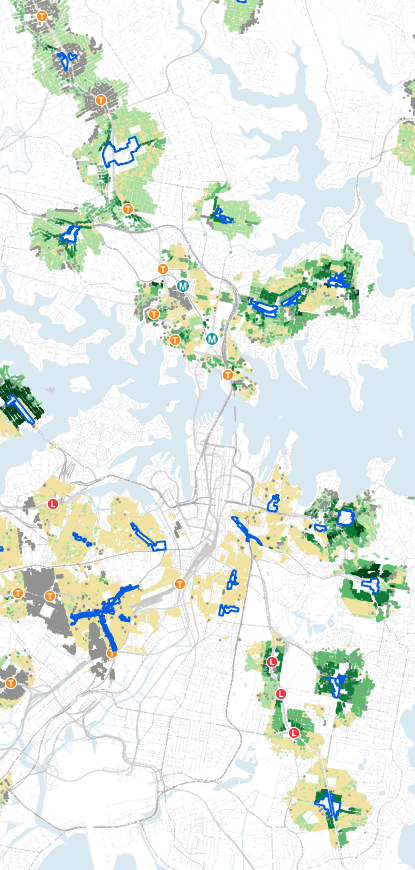
Per-property LMR & TOD uplift, mapped across NSW station catchments
For each property in an LMR area or a TOD mapped precinct:
Pricing (ex GST)
Delivered as a Microsoft Excel file.
Place an orderPlease use this form to place an order for the LMR/TOD dataset. An invoice and payment instructions will be sent by email after form submission. A data download link will be sent within 1 business day of receipt of payment.
Other datasets
CDC eligibility for all properties in an area of interest — contact us for the price list by LGA/suburb; minimum order $500.
We can also meet your custom needs relating to property and planning analysis. For CDC or other orders, please use the general request form.
Tell us about your request; we aim to respond within the same business day.
PropCode Insights
PropCode uses advanced algorithms to monitor planning regulation changes, identify impacted zones, and narrow down property listings. Our database that powers our platform includes:
All 3 million properties in NSW including multi-lot properties.
Numerous map layers including zoning, maximum height, floor space ratio, bushfire-prone land, and various others.
Adherence to zoning rules and special regulations outlined in all NSW LEPs and SEPPs plus proposed rules.
Example scenarios
Reach out to us if you have ever found yourself with questions like these:
I want to identify properties situated along a main street where childcare centres are permitted.
I want to find residential properties that have potential for rezoning and that are not affected by heritage.
I want to find mixed-use zone properties within a 10-minute walking distance of a transit station, where I can build up to 21m.